Putting The Upcoming Heat Wave Into Perspective
THE HOTTEST STRETCH IN 67 YEARS?
It’s been a very warm week but we have not really even gotten started with the heat. The upcoming pattern will not bring any daily record highs to our area BUT it will be notable for it’s LENGTH. Our current forecast calls for EIGHT consecutive days with highs of 90+. A string of 90+ degree days like this has not been seen for a while. A long while!

Can we get to 8 straight? Saturday, July 4th may be the wild card. I can see where will fall just short of 90 that day. A stray thunderstorm that moves over the airport early in the afternoon Wednesday and/or Thursday could short circuit the warm up those days. But the odds are low at this point.
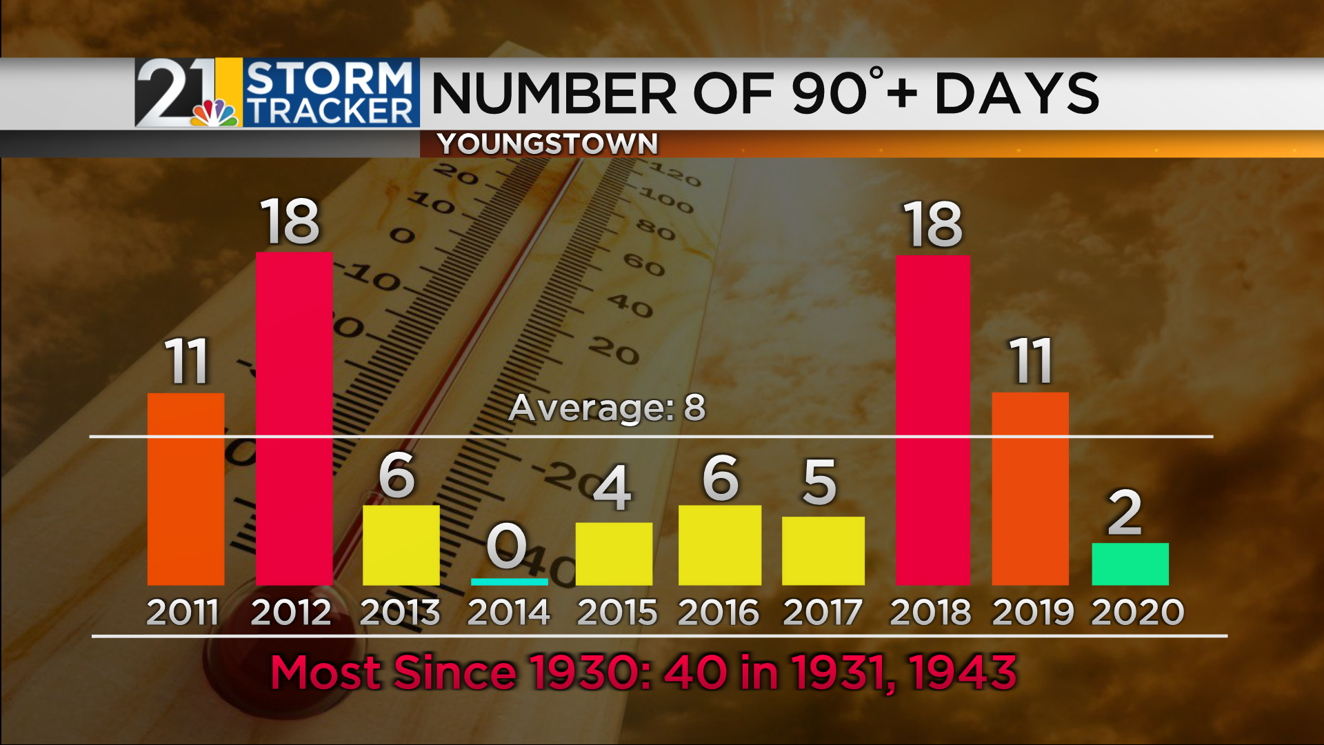
The Valley averages 8 90 degree days in an entire year so it would be quite something if we reel off that many in a row. We have had 2 such days so far this season.
A temperature above 92 has been very hard to come by of late. Last year we hot 91 several times and 92 has been achieved a handful of times in recent years. But the Youngstown-Warren Airport has not seen a temperature of 93 or above since the scorching hot July of 2012.

As I mentioned, it is unlikely that any daily records will be challenged during the upcoming stretch. The daily records in early July are all in the upper 90s and 100s. It is interesting to see how infrequently these lofty numbers occur here. Temperatures above 95 are especially rare. This is why experienced meteorologists rely on their knowledge of local climatology. Some models would have you believe that upper 90s are possible early next week, but it’s not usually wise to bet against history. Especially since we are not in a drought (yet), which can lead to higher odds of extreme heat .
