The Heat Is About To Break. Now What? A Few October Thoughts
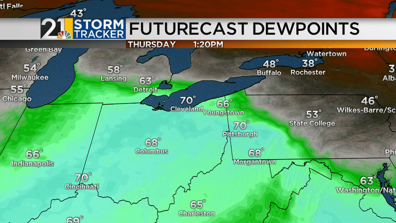
Thursday will be the last hurrah for “Endless Summer”. Some places are likely to see mid 80s for the last time until next spring/summer. Warmest temperatures Thursday will be in Columbiana County.

The air mass change from Thursday to Friday will be dramatic. Temperatures will be 25-30 degrees cooler with a big reduction in dewpoints. We’ll go from blasting the A/C in some places Thursday to perhaps needing to kick on the furnace late Friday night/early Saturday.
The second week of October is likely to feature a back-and-forth pattern with some cool days balanced out by some milder days. Notice the orange (mild) air masses dance with the blue (cooler) air masses in this animation:

At the end of that animation, you can see that much of the country looks pretty mild. The second half of the month does not look all that cool (compared to average) and October is likely to come out in the wash warmer-than-average.

ARE WE DONE WITH “HOT” WEATHER?
After Thursday, yes I think we are done with temperatures in the mid/upper 80s with crazy high humidity. I don’t want to rule out a day here and there that brings temperatures into the mid/upper 70s but they will be much less common than they have been.
WHAT ABOUT WINTER??
One season at a time, haha. My annual winter forecast will debut on Thursday, November 7. The “short version” will be on 21 News at 6&11 while the long, detailed, “geeky” version (both video and in blog form) will be posted online.