Very Cold November Pattern With Snow Chances Too

It was not that long ago that we were talking about endless summer…highs in the 80s were common early in October and air conditioners were still humming. November is getting underway with a much different flavor. Let’s touch on some specifics.

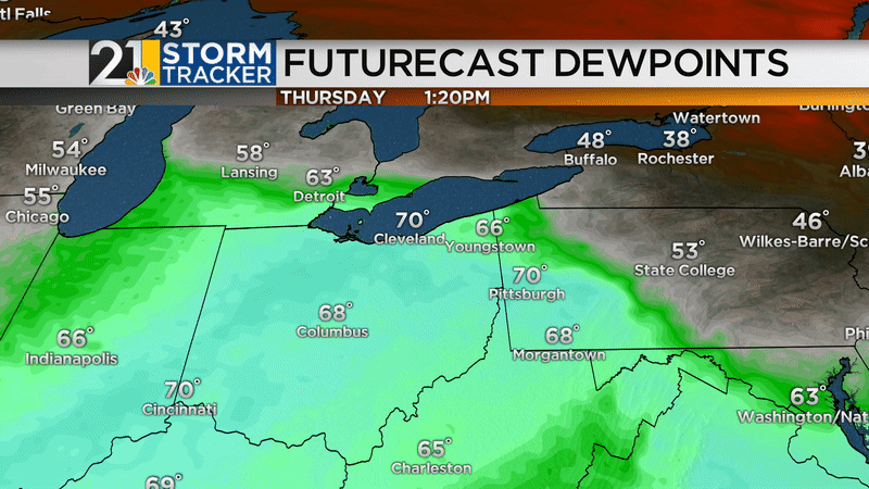
THURSDAY’S SNOW CHANCE

A cold front will cross the area Thursday morning and the temperature is expected to drop some throughout the day. Meanwhile, some moisture will “overrun” that front, leading to rising air and precipitation. It will take a while for the air up above our heads to cool sufficiently for snow production. That should occur at some point in the afternoon or evening. A changeover to wet snow will occur but honestly I don’t think we are in for much accumulation around here. The best moisture will be leaving us by the time it finally gets cold enough.

Simulated radar for the next few days:

9-km ECMWF USA Surface 1-Hourly Mid Atlantic 1-h Precip Type & MSLP.gif

Lake-effect flurries and snow showers will fly for a while into Friday morning. Local lake-effect accumulations will not be anything significant. Maybe an extra coating to an inch in northern Trumbull/Mercer.

Odds of 1” or more of snow Thursday into Thursday night (legend in lower left):

1inch.png

Odds of 2” or more:

2inches.png

National Weather Service snow forecast through 7am Friday:

nws.png

THE NEXT COLD SHOT

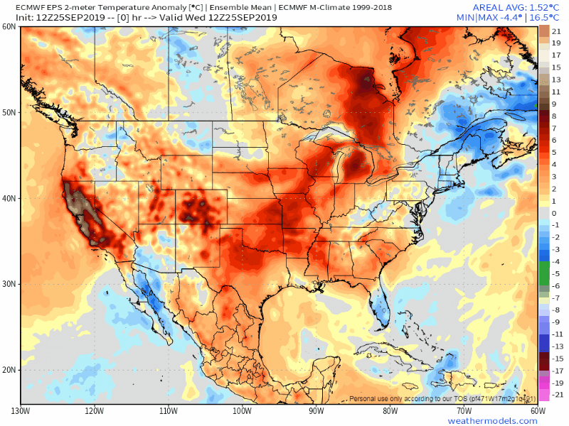
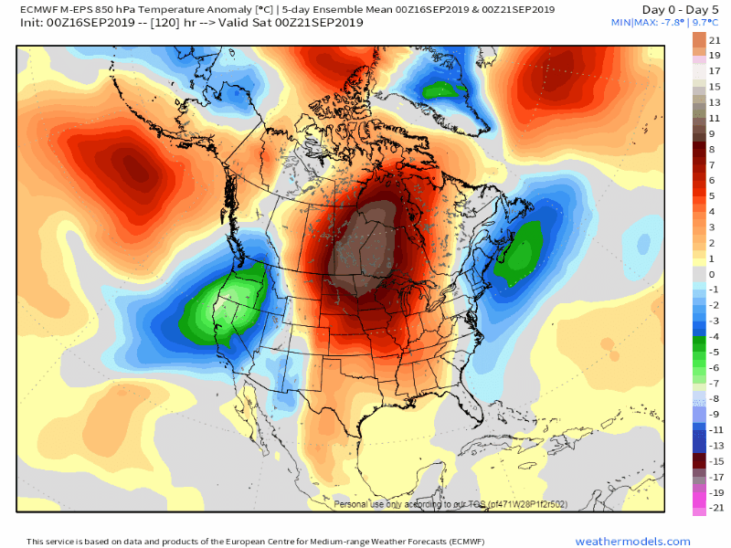
The arctic front that will cross The Valley Sunday/Sunday night is very impressive-looking for this time of year. It will usher in some serious cold for at least the first half of next week. It’s November so the Great Lakes are still quite mild compared to the air that will be blowing over them so lake-effect should be plentiful next week in the usual favored areas. Wintry-looking weather map next Tuesday:

tuesday.png

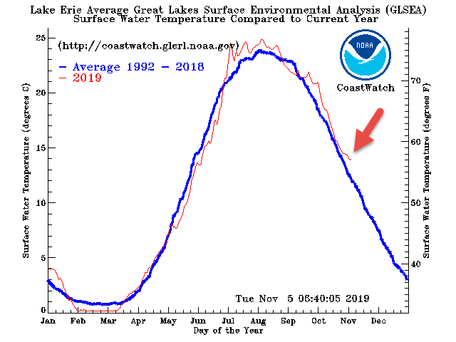
Water temperatures on Lake Erie are running above-average by a few degrees.

avgtemps-e_1992-2018.gif

THIS COLD SNAP HAS SOME LEGS!

Waves of cold will plunge south over the next 10 days to 2 weeks. If this were January we’d be talking about several subzero temperatures and nasty wind chills.

9-km ECMWF USA Cities United States 2-m Temperature Anom.gif
download.png

DOES THIS MEAN ANYTHING FOR WINTER?

It seems quite likely that, compared to average, November will be the coldest month of 2019. Only one month has been colder-than-average this year (March). Actually, for as much warming as our area has seen in recent years, we have had a fair amount of cold Novembers this decade. The last 3 have been cold and 6 of the last 8 have been below the average (black line).


nov.png

Does a cold November correlate to a cold winter?? Well, as with many things weather…the answer is complicated. More often than not, yes, a VERY cold November is followed by a colder-than-average winter. Here’s a composite of the winters that followed our top 10 coldest Novembers:

novanalogs.png

However, November 2018 was the 7th coldest November on record and the winter that followed was….ho hum. Mild December, typical January and warm February here.

lastwinter.png


WINTER FORECAST SOON!

May annual winter forecast will debut on 21 News at 6pm Thursday, with an encore at 11pm. Plus the long, geeks, detailed version will be posted online. More of a reader? I’ll have a written blog post (much like this one) here as well.

74533940_1422057861281186_2115132425318170624_o.jpg


The Heat Is About To Break. Now What? A Few October Thoughts

Thursday will be the last hurrah for “Endless Summer”. Some places are likely to see mid 80s for the last time until next spring/summer. Warmest temperatures Thursday will be in Columbiana County.

Futurecast Temperatures.png

The air mass change from Thursday to Friday will be dramatic. Temperatures will be 25-30 degrees cooler with a big reduction in dewpoints. We’ll go from blasting the A/C in some places Thursday to perhaps needing to kick on the furnace late Friday night/early Saturday.

ezgif.com-video-to-gif.gif

The second week of October is likely to feature a back-and-forth pattern with some cool days balanced out by some milder days. Notice the orange (mild) air masses dance with the blue (cooler) air masses in this animation:

14-km EPS Global United States 850 hPa Temp Anom.gif

At the end of that animation, you can see that much of the country looks pretty mild. The second half of the month does not look all that cool (compared to average) and October is likely to come out in the wash warmer-than-average.

CPC Monthly Temps.png

ARE WE DONE WITH “HOT” WEATHER?

After Thursday, yes I think we are done with temperatures in the mid/upper 80s with crazy high humidity. I don’t want to rule out a day here and there that brings temperatures into the mid/upper 70s but they will be much less common than they have been.

WHAT ABOUT WINTER??

One season at a time, haha. My annual winter forecast will debut on Thursday, November 7. The “short version” will be on 21 News at 6&11 while the long, detailed, “geeky” version (both video and in blog form) will be posted online.

november-7-flat-daily-calendar-icon-date-vector-8063225.jpg

Some Perspective On Next Week's Late-Season Heat Wave

More than likely you are aware that we have some unusual late-season heat coming our way early next week as September ends and October gets underway. But HOW unusual will this be? I thought I’d offer a few thoughts and stats on that subject.

THE SETUP

The pattern across North America will become highly amplified over the weekend early next week, as a strong trough of low pressure digs across the West. This will cause a huge, anomalous ridge of high pressure to pop across the East. If this were July, triple-digit heat would be common under the ridge and we’d probably be looking at mid 90s around here. It’s not midsummer anymore so temperatures can only get SO warm….but we’ll still see readings as much as 20-24 degrees warmer-than-average.

Eric Futurecast With MSLP Temp Contours.png

HOW HOT?

I think we have a legitimate chance of seeing 90 degrees on Tuesday, the first day of October. This would not only be a record high for that date, but an ALL_TIME record high for October. In recorded history, our area has not seen 90° after September 29.

Latest 90 Degree Temps.png

The average date of the last 90 of the year? In the middle of August!


last 90 Degree Days.png

Tuesday is the day in which 90 is most likely, but Monday and Wednesday will also be very warm/hot.

RecordsDatesYears.png

WARM SEPTEMBERS VERY COMMON LATELY

Over the last 30 years, September has actually seen the LEAST amount of warming compared to every other month. BUT, the last 5 years have been a different story. 2015 didn’t crack the top 10 but it was the 13th warmest. September 2019 will finish in the top 10 and perhaps even top 5.

Warning Temps By Month.png
Warm Septembers.png
GENERIC LIST.png

CLIMATE CHANGE LINK?

No single weather event or weather pattern can be directly attributed to climate change, especially while it is happening. Peer-reviewed study is needed and that takes time. That said, the rapidly warming atmosphere (and oceans) greatly increases the odds of extreme weather. The analogy I like to use is this: in the steroid era of baseball, every home run that was hit by Sammy Sosa, Barry Bonds, etc did not occur simply because they were using steroids. Many of those home runs would have occurred anyway. But the fact that they were using performance-enhancing drugs increased the odds that any given pitch would result in a home run.

Right now the planet “is on steroids” and so the odds of extreme weather patterns occurring is higher.

Climate Change.png

By the way, the oceans are absorbing a large portion of the heat. They are warming at an alarming rate and it IS impacting weather patterns. The oceans cannot sustain this and eventually the warming of the atmosphere is likely to make a significant jump upwards.

An alarming new report came out this week. It’s worth a read: https://www.nbcnews.com/news/world/cut-emissions-avert-catastrophic-sea-level-rise-u-n-study-n1058466

WHEN CAN I TURN INTO AUTUMN MAN/WOMAN?

Screen-Shot-2019-09-23-at-2.40.20-PM.png

The heat wave will break during the second half of next week and it’ll feel LIKE FALL next weekend. Probably some highs in the 60s and lows in the 40s. Not crazy cold…in fact just back to normal but it’ll finally feel crisp and cool for a while.

14-km EPS Global United States 2-m Temperature Anom.gif

DOES THIS MEAN ANYTHING FOR WINTER?

Nah, not really. Late summer/early fall weather patterns generally do not have a strong correlation to wintertime regimes. Stay tuned for my annual winter forecast in late October/early November.

Previewing This Year's Fall Foliage Season

While many wish summer would continue indefinitely, in eastern Ohio and western Pennsylvania we live in a 4 season climate. There are many things about autumn that are great and of course the annual changing of the leaves is high on the list. We are lucky to have so many great spots (such as Mill Creek Park) to take in the show.

In 2018, a very warm and wet September and a toasty start to October kind of doomed the foliage season. We were not alone in seeing “forever summer”; here’s last September temperature anomalies:

September 2018 Temperatures

September 2018 Temperatures

Many leaves simply turned brown and fell. The “peak” wasn’t much of one and it was very late…close to Halloween.

Our “typical” peak is somewhere between October 15-25.

Foliage Map.png

WHAT ABOUT THIS YEAR

September is off to a very warm start again this year. And once again, we are not alone:

prism_conus_tavg_anom_SEP2019.png

But, at least in parts of the area, it has not been as wet this September. Some places, mainly south of 224 are quite dry. It’s been wetter in much of Trumbull and Mercer counties during the second half of summer.

September 1-17 Rain

September 1-17 Rain

So it hasn’t been as wet as last September and that is a positive for the potential of a vivid show this year. BUT, much like last year the very warm pattern is likely to continue into late September and early October. Some of the long-range modeling is very toasty looking through the first half of October.

Long-range European model

Long-range European model

So, while the generally drier weather should help, I’m concerned about the late-season warmth short-circuiting the fall colors again this year. It should be better than 2018 but likely not as good as some of our better years.

Why do the leaves change color? As the days get shorter, chlorophyll is depleted, allowing other pigments (instead of green) to come out of hiding.

Why Leaves Change Color.png

Autumn officially gets underway very early in the day Monday.

First Day of Autumn.png

Quick Summer 2019 Review

Summer 2019: A Warm, Stormy One

Summer (June-August) will go into the record books as a warm one with all 3 months ending up warmer-than average. July was the hottest vs. average. June of course was very wet. July and August brought less rain although we still had frequent storms and bouts of heavy rain, especially in Trumbull and Mercer counties. It was the wettest summer since 2003 and the 6th wettest on record.

Summer So Far.png
Summer Rain 1997-2016.png
Summer Temps 1997-2016.png